
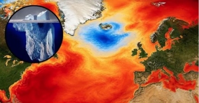
Beneath the thick layer of Antarctic ice lies an entire world that has long remained almost inaccessible to scientists. Now, researchers have managed to peer under the continent's glacial cover and synthesize the most detailed digital map of the terrain buried under kilometers of ice. This discovery will help more accurately predict how glaciers will melt and how quickly global sea levels will rise.
What they managed to see beneath the glacial cover
The new map is the result of combining satellite observations and computational modeling based on the physics of ice movement. Scientists correlated data from the Antarctic surface with the way glaciers shift, allowing them to reconstruct the hidden landscape. As a result, a multitude of previously unknown formations were identified—mountain ranges, valleys, and canyons located beneath a layer of ice three miles thick. These relief forms are not only significant from a geographical perspective; they are what influence the speed at which ice masses slide toward the ocean. "It’s like the old days: you had a grainy film camera and now you have a properly enlarged digital image of what’s actually happening," explained study co-author and geologist Helen Ockenden.
Why previous methods did not provide a complete picture
Until now, scientists relied primarily on radar measurements taken from airplanes or snow crawlers. Such surveys provided accurate data but covered only specific paths. Between them remained vast "gaps" tens of kilometers wide, where the terrain relief simply had to be guessed. According to glaciologist Robert Bingham, such work was like trying to imagine the Alps having made only a few flights over them. The image was fragmentary and did not allow for an understanding of the overall scale of processes.
How ice movement helped "fill in" the map
To fill the gaps, scientists used a principle similar to how river flow works. If a river has rocks or hollows on its bed, the water changes speed and direction. Something similar happens with glaciers: they accelerate or decelerate depending on what lies beneath them. Researchers analyzed the movement speed of ice masses and created a model of the subglacial terrain. They then verified it by comparing the results with existing radar data. This approach allowed for the creation of an almost seamless map of the hidden landscape.
Which structures the scientists found
The result was impressive. The team identified more than 30,000 hills with a height of at least 50 meters. Additionally, scientists discovered a giant channel with steep slopes—about 50 meters deep, 6 kilometers wide, and over 400 kilometers long. "Such findings are important for understanding where glaciers can move faster and where their movement will slow down due to rock friction," argues geologist Alexey Trofimov.
Limitations and significance of the map
Despite its advantages, the technology also has weaknesses. It does not allow for the detailed examination of small relief elements, especially if their width is smaller than the thickness of the ice layer. Glaciologist Duncan Young compared this method to trying to understand what is under a thick blanket: the general shapes are discernible, but small details remain hidden. However, the new map gives scientists a key tool for predictions. The underlying rocks create friction and literally control ice movement. The more accurate the understanding of the subglacial relief, the more accurately the speed of glacier melting and future changes in sea level can be estimated.
www.bankingnews.gr


Σχόλια αναγνωστών